Perseverance's Martian Selfie: Exploring Lac de Charmes
NASA's Perseverance rover continues to amaze with its latest self-portrait, taken against the dramatic backdrop of ancient Martian terrain at a site dubbed "Lac de Charmes." This Q&A breaks down the details of the image, the science behind it, and what it tells us about the rover's journey. Jump to the first question to learn about the selfie composition.
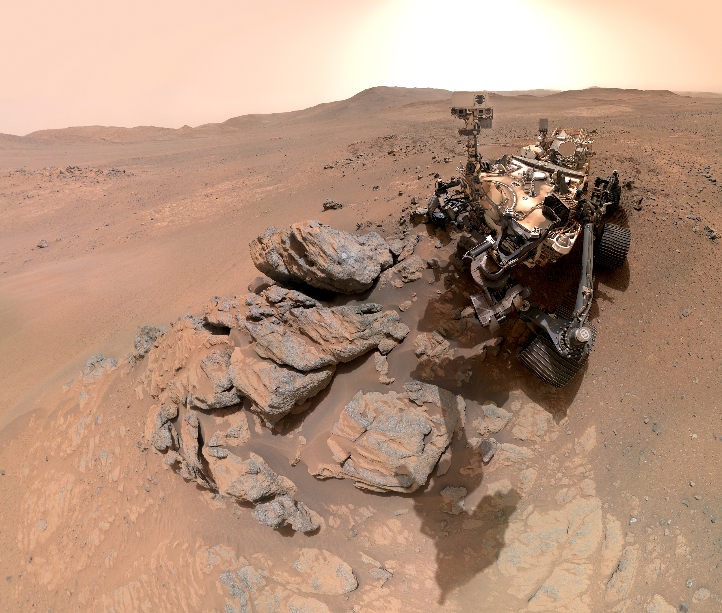
What does Perseverance's latest selfie show?
The selfie, assembled from 61 individual images, captures the rover with its mast trained on a nearby rocky outcrop. In the foreground, you can see a circular abrasion patch created by the rover's drill. The background stretches across the western rim of Jezero Crater, offering a sweeping view of the ancient Martian landscape. The image highlights the rover's recent activity—grinding down a small portion of rock to expose its interior for analysis.
Why did Perseverance create an abrasion patch?
Abrading is a key part of the rover's science mission. By grinding away the weathered surface of a rock, Perseverance exposes fresh, unaltered material underneath. This allows the science team to use the rover's instruments—like the SHERLOC spectrometer and PIXL X-ray imager—to analyze the rock's chemical composition and search for signs of past microbial life. The circular patch at Lac de Charmes is one of many such abrasions performed during the mission.
How was the selfie taken and assembled?
The selfie was captured using the WATSON camera on the rover's robotic arm. Over the course of a single Martian day, the camera took 61 separate images, each focused on a different part of the scene. These images were later stitched together back on Earth to create a seamless panoramic portrait. The process required precise positioning of the arm to avoid shadows or gaps, and the result shows Perseverance as both photographer and subject.

What is Jezero Crater, and why is it important?
Jezero Crater is a 45-kilometer-wide impact crater on Mars that scientists believe once contained a lake and a river delta. It was chosen as Perseverance's landing site because its ancient sedimentary rocks may preserve evidence of past life. The crater's western rim, visible in the selfie, marks the boundary of this ancient basin. The rover has been exploring the crater floor and delta since landing in February 2021.
When and where was this selfie taken?
The image was captured on March 11, 2024—the 1,797th Martian day (or sol) of the mission. The location is called "Lac de Charmes," a region near the western edge of Jezero Crater. This spot represents the rover's deepest push west so far, as it continues to traverse the crater's rim and search for promising rock samples. The selfie documents a milestone in Perseverance's ambitious exploration plan.
What does this selfie tell us about the mission's progress?
The selfie is more than just a pretty picture. It confirms that Perseverance is actively conducting in-situ science at a new, exciting location. The abrasion patch shows the team is prioritizing sample analysis, while the background view hints at the rugged terrain ahead. Each selfie serves as a visual log of the rover's journey, helping scientists and the public track its achievements. With over 1,800 sols of operation, Perseverance continues to exceed expectations.
Related Articles
- How to Observe Wave-Like Behavior in Antimatter Atoms: A Step-by-Step Guide for Researchers
- Enterprise AI at Crossroads: New Hybrid Framework Combines Low-Code Speed with Full-Code Control – Analysts Say It's the Missing Link
- Building and Understanding Dual-Core Quantum Computers: A Deep Dive into the Hanyuan-2 Architecture
- Breaking: Scientists Uncover Hidden 'Olfactory Map' in Nose That Reveals How Smell Works
- Embracing Finitude: A Step-by-Step Guide to Thinking Without Infinity
- Samsung Kicks Off One UI 9 Beta Program for Galaxy S26 Series: Key Improvements and Availability
- Rethinking Fat Metabolism: A Protein's Dual Role Sheds Light on Obesity
- Breakthrough in AI Debugging: New Method Identifies Which Agent Caused Multi-Agent System Failures